Lava flow map of the 2021 Fagradalshraun volcanic eruption
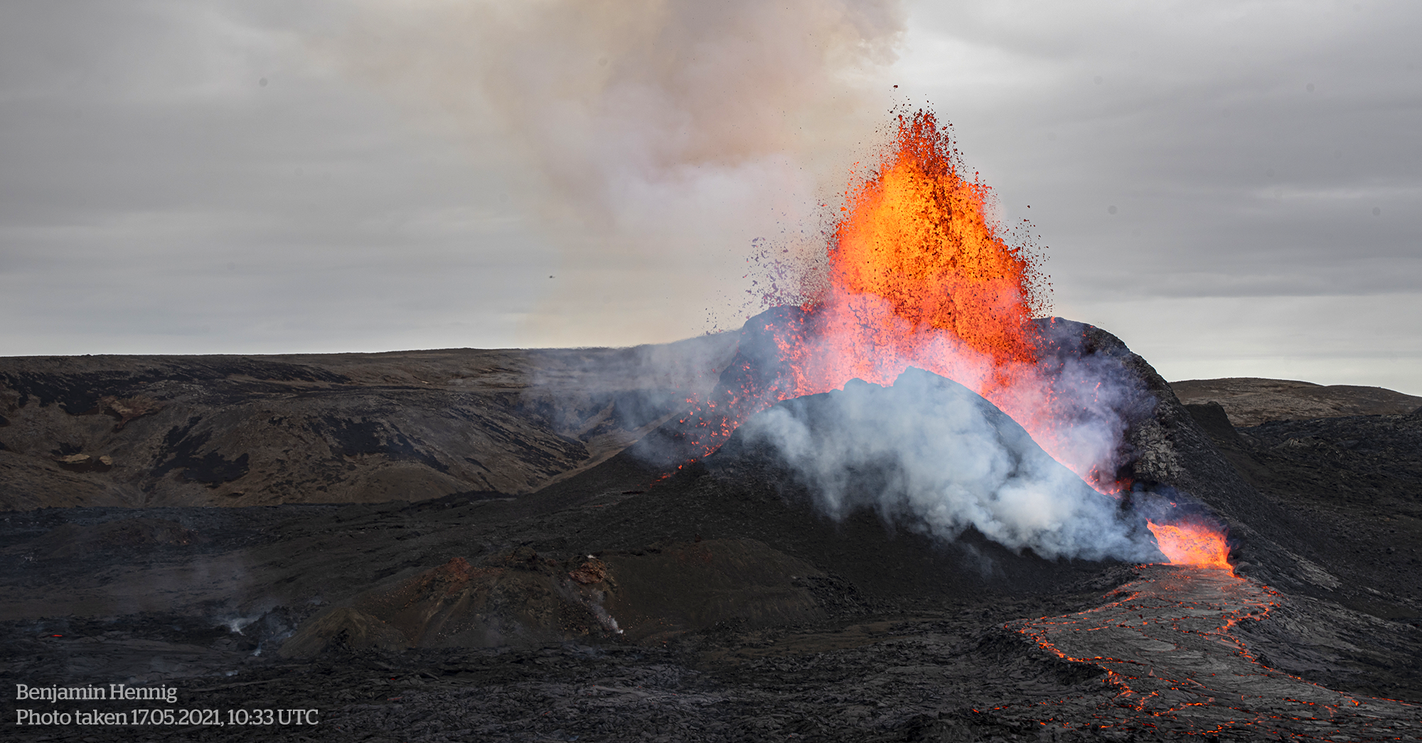
On 19. March 2021 a volcanic eruption started in the Geldingadalir valley at Fagradalsfjall mountain on the Reykjanes peninsula, South-West Iceland. The new lava field was named Fagradalshraun and after the first 6 months of activity had grown to cover an area of 4.8 square kilometers. The volcano is situated approximately 30 km from the country’s capital city, Reykjavík. Although active lava flows have not been detected since late September, the eruption has been changing the landscape in the valley and its surrounding area considerably.
The following map provides a snapshot of the situation in the area at the end of this active and dynamic period. It shows the volcano with its vent systems in its geographic context and provides an overview of the lava flows and situation in the field as of 28 October 2021:
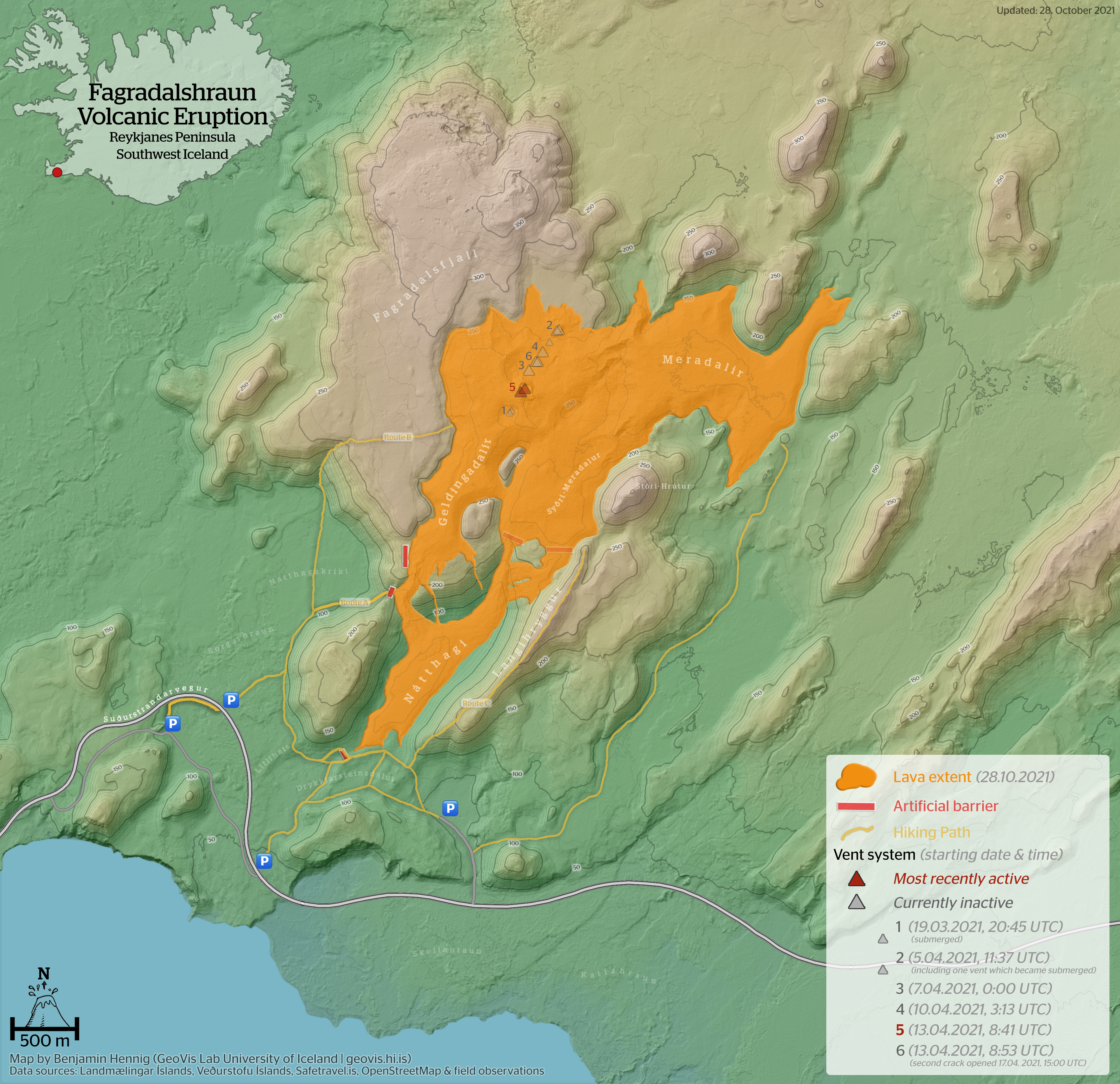
Map of the Geldingadalur Volcanic Eruption and its lava flows at Fagradalsfjall/Iceland, updated October, 28th 2021