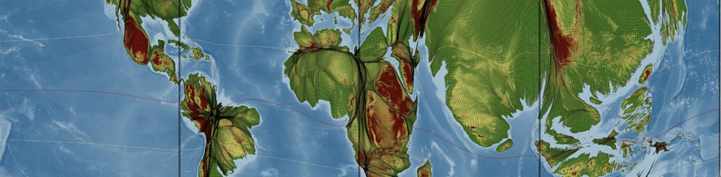
Category: maps

Spatial Analysis & Geovisualisation Research Group at the University of Iceland

Meradalir 10 August 2022, Photo by Scott Riddell

Lava flow map of the 2022 Meradalir volcanic eruption

A renewed volcanic eruption started on 3 August 2022 in the north-eastern part of the 2021 eruption site on the Reykjanes peninsula in Iceland which keeps changing and transforming the landscape in the valley and its surrounding areas as a result.

Geldingadalur Volcanic Eruption (17. May 2021)

Lava flow map of the 2021 Fagradalshraun volcanic eruption

On 19. March 2021 a volcanic eruption started in the Geldingadalir valley at Fagradalsfjall mountain on the Reykjanes peninsula, South-West Iceland. The new lava field was named Fagradalshraun and after the first 6 months of activity had grown to cover an area of 4.8 square kilometers.

Cubic Globe – Population Cartogram Edition

A cartogram is a map that displays areas proportional to variables of interest. A population cartogram, for example, shows an area resized according to the number of people who live there, so that unpopulated areas disappear from such a map. This foldable globe is such a cartogram representation, showing a gridded population cartogram projected onto…
Read more