Lava flow map of the 2022 Meradalir volcanic eruption
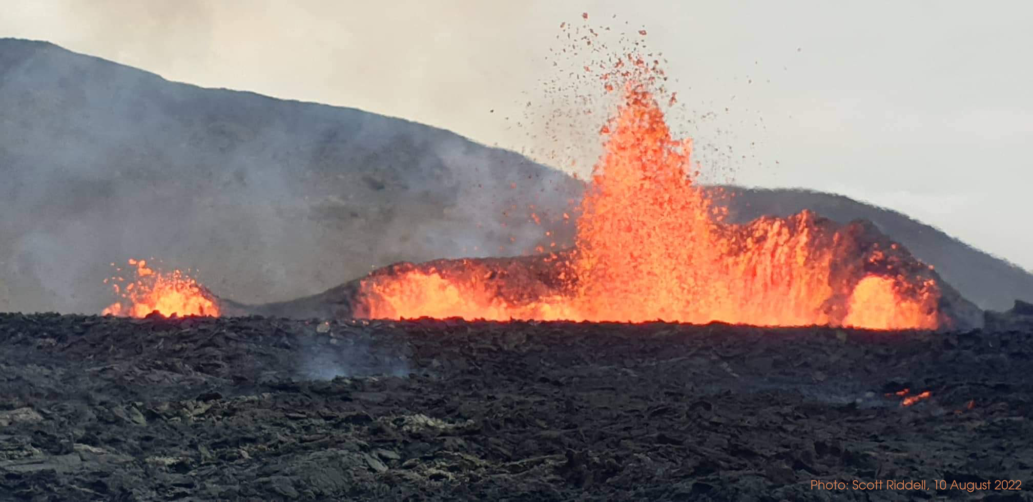
A renewed volcanic eruption started on 3 August 2022 in the north-eastern part of the 2021 eruption site on the Reykjanes peninsula in Iceland which keeps changing and transforming the landscape in the valley and its surrounding areas as a result. The volcano is situated approximately 30 km from the country’s capital city, Reykjavík. The main extent of the lava flows currently covers parts of Meradalir, mostly flowing over last year’s new lava fields.
The following map provides a snapshot of the situation in the area after two weeks of activity. It shows the volcano with its vent systems of 2021 and 2022 in their geographic context and provides an overview of the 2021 (orange) and 2022 (red) lava flows and situation in the field as of 15 August 2022:
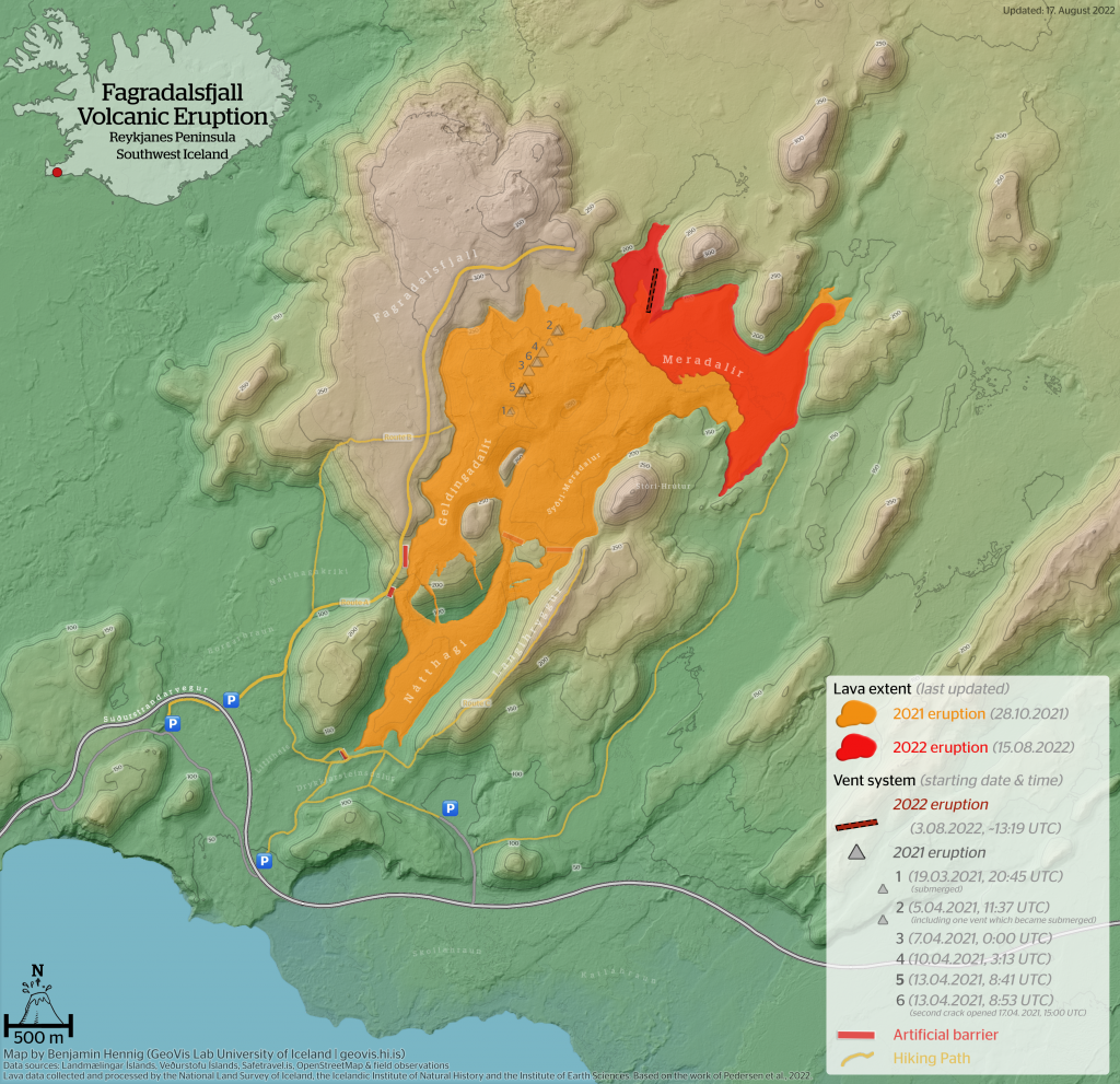
Map of the Meradalir Volcanic Eruption and its lava flows at Fagradalsfjall/Iceland, updated August, 17th 2022